
Ambit provides point cloud processing services, including custom labelling, classification, object extraction, data analysis and conversion.
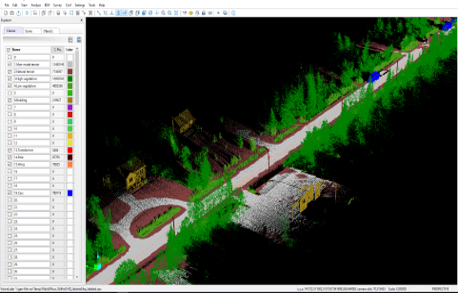
Point Clouds Auto Classification
Ambit utilizes AI-powered algorithms to automatically classify point cloud data with high accuracy and efficiency. By leveraging machine learning and intelligent feature recognition, it streamlines the segmentation of objects such as buildings, vegetation, and infrastructure.
Object Extraction
With the help of AI technology, objects can be efficiently identified and extracted from large point clouds dataset. This technology intelligently detects and separates structures such as buildings, roads, and vegetation, thereby optimizing data processing workflows in urban planning, construction, and asset management.
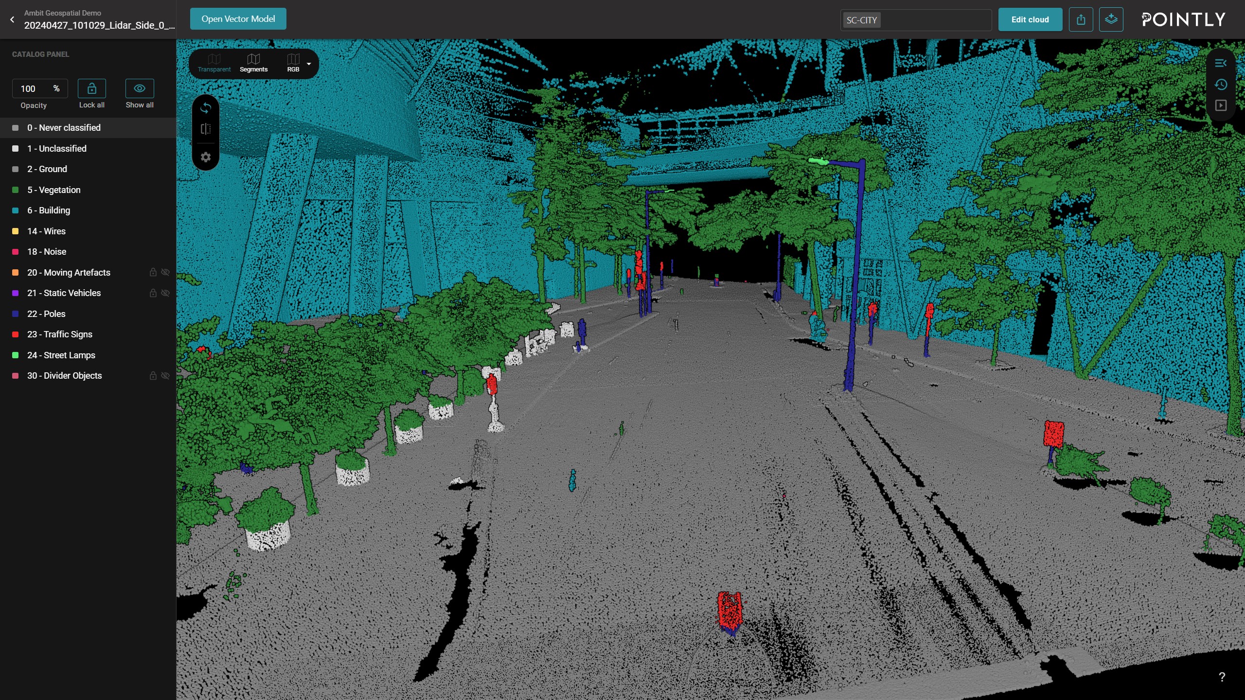
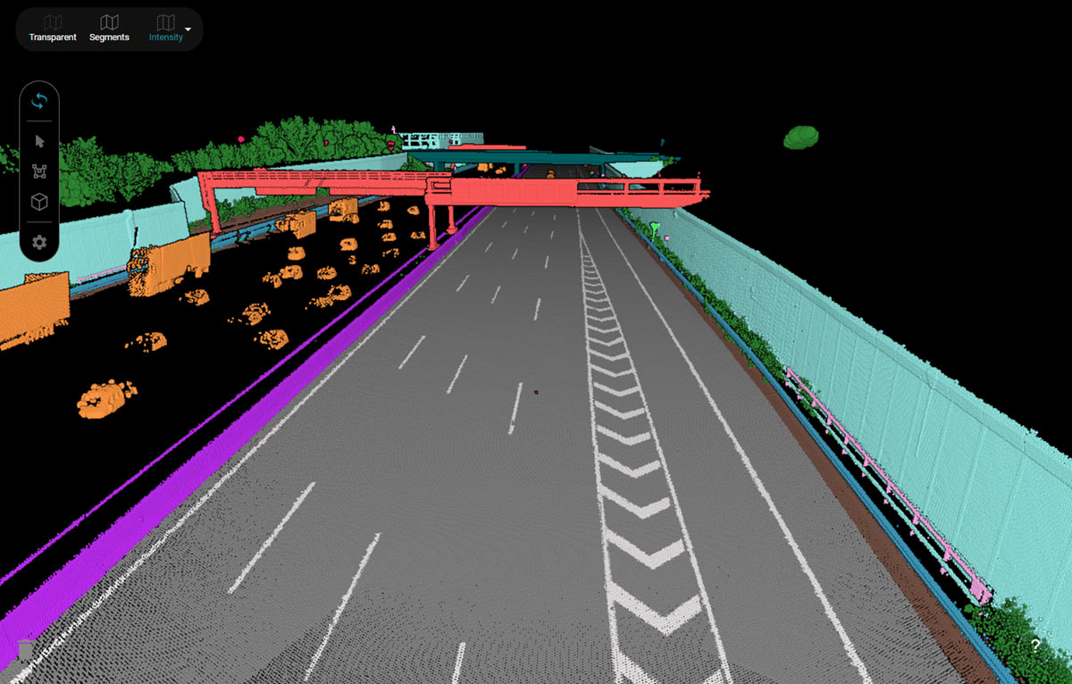
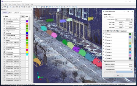
Recognition & Data Structuring
Ambit uses AI-driven classification and segmentation to automatically detect and organize road and bridge features from point cloud data. This improves infrastructure management by accurately identifying elements such as road surfaces, lane markings, guardrails, bridges, and supporting structures. By structuring the data efficiently, Ambit supports road condition assessments, bridge inspections, and maintenance planning, enabling faster processing, greater accuracy, and better decision-making for transportation networks.
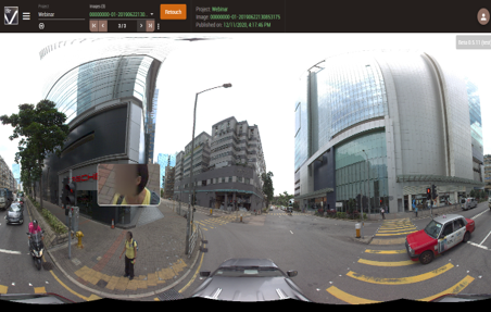
AI Image Analysis and Auto Face Blurring
Our AI Auto Anonymization service uses advanced GeoAI technology to automatically detect and blur human faces and vehicle license plates in imagery and video data. This ensures compliance with privacy regulations such as GDPR and CCPA, while maintaining the usability and integrity of high-resolution visual content.
Designed for applications in aerial imagery, street-level mapping, surveillance, and smart city projects, the system accurately processes complex scenes, applying precise blurring to protect personal identities without manual intervention.
By automating the anonymization process, organizations can significantly reduce time and cost, while upholding ethical standards in data sharing and publication. Whether integrated into a larger GeoAI pipeline or used as a standalone solution, our service supports scalable, fast, and privacy-conscious data workflows—ensuring you can manage and publish visual content with confidence.
Train Your Own AI Point Cloud Model with Ease
With our intuitive GeoAI platform, you can create your own trained point cloud model using annotated datasets tailored to your specific project. The system allows you to export projects fully prepared for the training process, supporting both RGB and intensity-based workflows.
Set up your model efficiently by breaking down your dataset into training and validation sets, ensuring balanced and optimized performance. Whether you're working on object detection, classification, or segmentation, our tool simplifies the pipeline for custom AI model development.

Ambit Geospatial Solution and third parties collect personal information as specified in the privacy policy and use cookies or similar technologies for technical purposes and, with your consent, for experience, measurement and marketing (personalized ads) as specified in the cookie policy.
You can freely give, deny, or withdraw your consent at any time by accessing the preferences panel. Denying consent may make related features unavailable.
Use the “Accept” button to consent. Use the “Reject” button to continue without accepting.