
Ambit offer advanced underwater surveying services using cuttingedge LiDAR technology to monitor, map, and assess underwater infrastructure with high precision. Our service provide detailed, reliable data for applications such as pipeline inspection and structural assessment.
LiDAR Scanning Approach
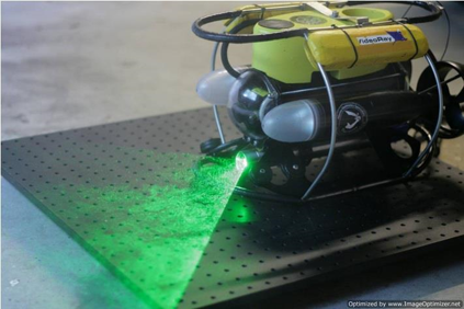
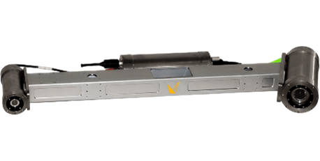
Traditional underwater inspection approaches, typically performed by divers or using echosounders, are either inefficient or lack of accuracy. Ambit proposes the use of underwater LiDAR to conduct underwater infrastructure inspections. By mounting the LiDAR scanner on remotely operated vehicles (ROVs), safety risks are largely reduced, as team members can perform inspections from a ship.
Two widely adopted ROVs are used as the primary and backup system. Both of these support configurations such as scanner and camera.
ROV - Specification
|
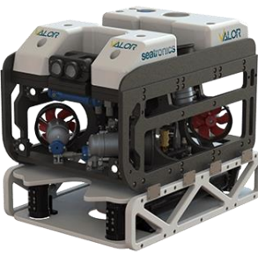
Smartfly 300 System |
|
|
Size |
1050 x 800 x 1200 mm |
|
Weight |
250 kg (Dry) |
|
Max Depth |
300m Standard |
|
Max Speed |
1.5 m/s (3knots) |
|
Power Supply |
6KW / AC power |
ROV - Specification
|
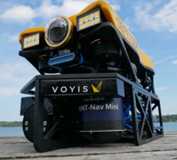
VideoRay's Defender System |
|
|
Size |
711 x 394 x 238 mm |
|
Weight |
17.2 kg (Dry) |
|
Max Depth |
300 m Standard |
|
Max Speed |
1.95 m/s (3.8 knots) |
|
Power Supply |
AC power |
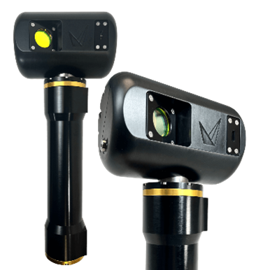
Ambit offers 3 types of LiDAR scanner to suit different requirements and scenarios.
Scanner - Specification
|
Insight Nano |
|
|
Scan Range |
0.13m - 1m or 0.36m - 2.5m |
|
Profile Rate |
35Hz |
|
Points Per Line |
2064 |
|
Laser |
Class 3R Laser Product |
|
Data Format |
.XYZ (CSV), LAS Publishing |
|
Depth Rating |
1000m |
|
Data Acquisition |
Real-time processing | ViewLS Software | C++ API | Factory Calibrated |
Scanner - Specification
|
Insight Micro |
|
|
Scan Range |
0.7m - 5.0m (SR) | 1.0m - 7.0m (XR) |
|
Profile Rate |
50 Hz Laser with 3Hz Stills Imaging |
|
Points Per Line |
2464 |
|
Laser |
Class 3B Laser Product |
|
Data Format |
Laser: .XYZ (CVS), LAS Publishing | Stills: .JPG, .TIFF |
|
Depth Rating |
1000m or 4000m |
|
Data Acquisition |
Real-time processing | ViewLS, C++ API (included) |
Scanner - Specification
|
Insight Pro |
|
|
Scan Range |
1.5m-15m |
|
Profile Rate |
90Hz with range limiting |
|
Points Per Line |
2048 |
|
Laser |
Class 3B Laser Product |
|
Data Format |
.XYZ (CSV), LAS publishing |
|
Depth Rating |
4000m or 6000m options |
|
Data Acquisition |
Real-time processing | ViewLS, C++ API (included) |
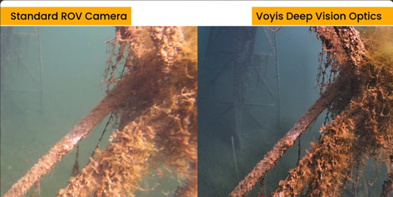
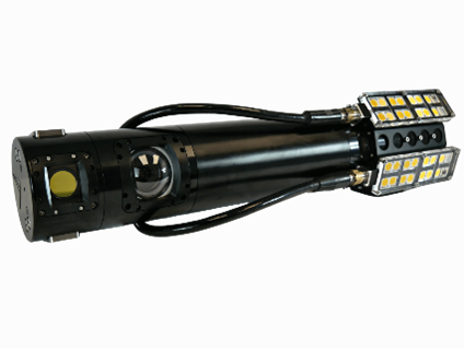
Enhanced Colour Images
A digital twin model of the underwater infrastructure will be created for assessment, along with true colour images that are corrected and enhanced by the Voyis optical system.
Ambit Geospatial Solution and third parties collect personal information as specified in the privacy policy and use cookies or similar technologies for technical purposes and, with your consent, for experience, measurement and marketing (personalized ads) as specified in the cookie policy.
You can freely give, deny, or withdraw your consent at any time by accessing the preferences panel. Denying consent may make related features unavailable.
Use the “Accept” button to consent. Use the “Reject” button to continue without accepting.