
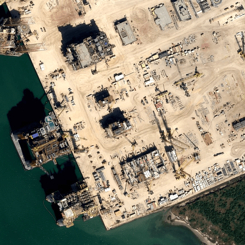
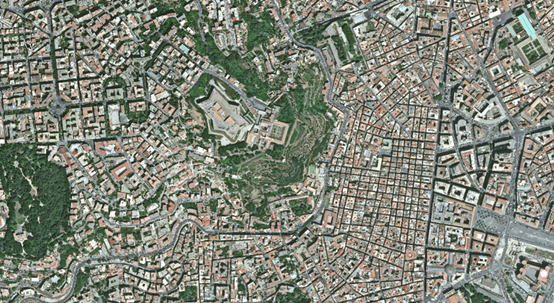
Our Satellite Tasking Service provides on-demand access to 30cm Very High-Resolution (VHR) imagery, enabling precise and timely data collection for any location worldwide. By leveraging leading satellite constellations, we offer customized image acquisition based on your preferred date, time, and area of interest. This service is ideal for projects that require up-to-date, cloud-free imagery for urban planning, infrastructure monitoring, environmental analysis, and emergency response.
With spatial detail fine enough to distinguish road markings, vehicles, and small structures, our 30cm VHR imagery supports detailed mapping and analytics. Flexible tasking plans—including priority, standard, and archive options—ensure timely delivery aligned with your needs and budget. Processed imagery is typically available within 1–3 days of acquisition.
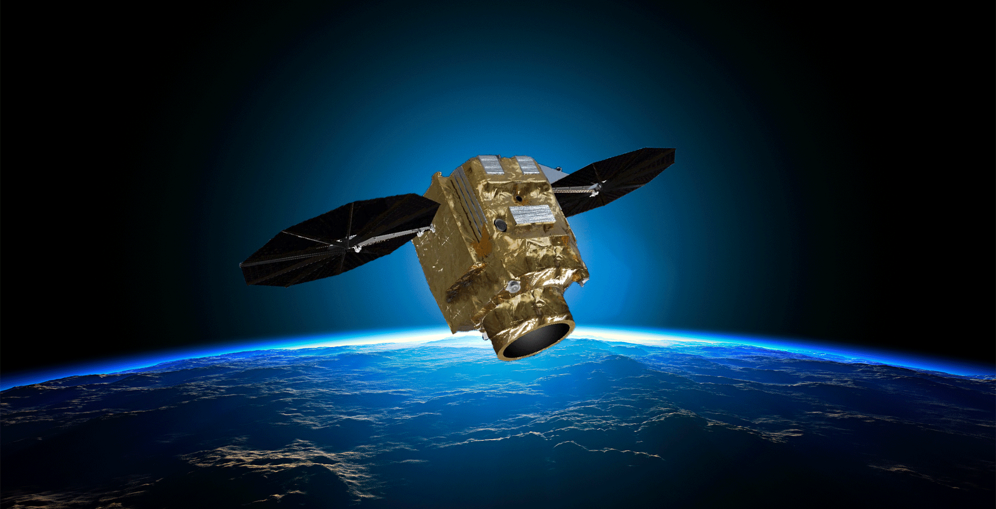
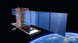
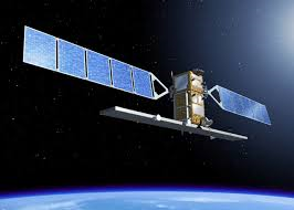
Pléiades Neo Tasking Service
Our Satellite Tasking Service leverages the powerful capabilities of Pléiades Neo, Airbus’ latest very high-resolution satellite constellation, to deliver on-demand 30cm imagery with unmatched clarity, speed, and precision. Designed for professional applications that require the highest spatial detail, Pléiades Neo enables users to detect fine features such as road markings, individual vehicles, rooftop structures, and more—making it ideal for urban mapping, infrastructure monitoring, land use analysis, and emergency response.
Flexible Tasking & Rapid Delivery
Through flexible tasking options, users can schedule custom acquisitions over any area of interest, with frequent revisit times and high acquisition capacity ensuring rapid coverage and delivery. Imagery is typically available within 24 to 72 hours after capture, depending on priority level and weather conditions. Pléiades Neo’s advanced optics and native 30cm resolution make it one of the most accurate and responsive commercial Earth observation platforms available.
Reliable Imagery for Critical Applications
Whether you’re conducting change detection, 3D modeling, environmental assessments, or disaster management, our service provides a dependable solution for acquiring up-to-date, cloud-optimized imagery anywhere in the world. Combined with expert planning support and streamlined delivery, this service ensures that you get precise, actionable data—exactly when and where you need it.
Pléiades Neo – Technical Specifications
Pléiades Neo is Airbus' next-generation optical Earth observation satellite constellation, offering 30cm native resolution imagery and enhanced agility for faster, more detailed data collection.
| Specification | Details |
|---|---|
| Resolution (Panchromatic) | 30 cm (native) |
| Resolution (Multispectral) | 1.2 m (Blue, Green, Red, Near-Infrared) |
| Swath Width | 14 km at nadir |
| Revisit Frequency | Up to 2 revisits per day (with full constellation) |
| Geolocation Accuracy | <5 m CE90 (without GCPs) |
| Spectral Bands | 4 multispectral + 1 panchromatic |
| Tasking Responsiveness | <15 minutes (for emergency tasking via direct access) |
| Max Acquisition Capacity | ~2 million km² per day (full constellation) |
| Stereo/Tristereo Collection | Supported |
| Delivery Time | 24–72 hours after acquisition |
| Data Formats | GeoTIFF, DIMAP, NITF, and others |
Pléiades Neo combines ultra-high resolution, fast tasking, and global accessibility, making it a premier solution for users requiring precise, timely, and high-quality satellite imagery.
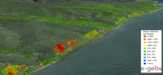
InSAR Land Monitoring
Interferometric Synthetic Aperture Radar (InSAR), is an effective way to measure changes in land surface altitude. By comparing SAR observations acquired over time, InSAR can detect very small ground movements with high level accuracy. SAR, as an active microwave remote sensing technology, is not affected by weather conditions such as cloud cover, fog, lighting conditions. The key advantage of using SAR is that it can reliably acquire surface information both day and night.
Our SAR satellite provider offers both high resolution radar data and end to end data processing services to support terrain monitoring. We aim for millimeter level accuracy, helping clients identify early stage ground changes and supporting risk assessments for slopes and infrastructure.
COSMO-SkyMed – Technical Specifications
The COSMO-SkyMed (Constellation of small Satellites for the Mediterranean basin Observation) Series consists of two generations of Synthetic Aperture Radar (SAR) satellites with the overall objective of providing frequent all-weather Earth observation, which can be applied to defence and civil needs
| Specification | Details |
| Resolution | 1m (spotlight), 3m (stripmap), 15m, 30m |
| Swath Width | 10km (Spotlight mode), 40km (Stripmap), 100km (ScanSar), 200km (ScanSar Huge) |
| Revisit Frequency | 16 days, 1 day for certain regions (with 4 satellites) |
| Spectral Band | X band SAR |
| Temporal Extent | June 8, 2007 to present |
| Orbit Type | Sun-synchronous |
| Orbital Altitude | 619.6 km |
| Orbit Period | 97.1 minutes |
| Orbit Inclination | 97.8 deg |
Sentinel 1 – Technical Specifications
Sentinel-1 constellation, includes twin satellites that each carry C-band synthetic aperture radar (SAR) and together provide all-weather, day-and-night imagery of Earth's surface.
|
Specification |
Details |
|
Resolution |
25 x 40 m, 5 x 5 m, and 5 x 20 m |
|
Swath Width |
80 km, 250km, 400km |
|
Revisit Frequency |
12 days (One Satellite), 6 days (both satellites) |
|
Spectral Band |
C Band |
|
Temporal Extent |
April 3, 2014 - present |
|
Orbit Type |
Sun-synchronous |
|
Orbital Altitude |
693 km |
|
Orbit Period |
98.74 minutes |
|
Orbit Inclination |
98.19 deg |

Ambit Geospatial Solution and third parties collect personal information as specified in the privacy policy and use cookies or similar technologies for technical purposes and, with your consent, for experience, measurement and marketing (personalized ads) as specified in the cookie policy.
You can freely give, deny, or withdraw your consent at any time by accessing the preferences panel. Denying consent may make related features unavailable.
Use the “Accept” button to consent. Use the “Reject” button to continue without accepting.